
Hurricane Erin's Offshore Path Brings Hazardous Surf to Florida's Space Coast |
Residents Urged to Exercise Caution Amid Elevated Rip Current Risks |
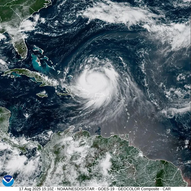 |
Hurricane Erin, currently a Category 2 storm with sustained winds near 100 mph, is charting a course that keeps it well offshore of Florida's Space Coast. Despite its distant trajectory, the storm is generating significant oceanic disturbances, leading to hazardous surf conditions along the coastline.
As of August 20, Erin was positioned approximately 450 miles east of Brevard County, moving north-northwest at around 10 mph. Forecast models indicate that while the hurricane will remain at sea, its influence will be felt along Florida's eastern shores. The National Weather Service in Melbourne has issued advisories highlighting the potential for dangerous rip currents and elevated surf heights.
Beachgoers in areas such as Indialantic have already observed the ocean's increased volatility. Brevard Ocean Rescue Chief Eisen Witcher emphasized the importance of vigilance, stating, "Don’t underestimate the ocean; it can change at a moment’s notice." He advised swimmers caught in rip currents to remain calm, signal for assistance, and swim parallel to the shore until free from the current's grip.
Local authorities have taken proactive measures to ensure public safety. Temporary mobile traffic signs displaying cautionary messages have been deployed along roadways, and red flags are prominently displayed on beaches to alert visitors to the high-risk conditions. The National Weather Service has also issued a High Surf Advisory for Flagler, Volusia, and Brevard counties, warning of breaking waves between 5 to 8 feet and an ongoing high risk of rip currents, especially during high-tide cycles.
The cruise industry is also closely monitoring Hurricane Erin. Royal Caribbean’s Vision of the Seas was forced to dock at Port Canaveral due to the storm. The ship is headed to the Bahamas and due back to Baltimore on Saturday.
The National Hurricane Center has predicted between 13 to 18 named storms for the year. Residents are advised to monitor weather conditions.
As Hurricane Erin continues its path, residents and visitors are urged to stay informed through official channels and adhere to safety advisories. The combination of rough surf, strong rip currents, and potential beach erosion underscores the importance of caution during this period of heightened ocean activity. |